Central Station Block Development Opportunity
This unique development opportunity, in the heart of Saint Paul’s Central Business District (CBD), is a 1.66-acre site intersected by the METRO Green Line Light Rail Central Station. The site covers most of a city block, and the remainder of the block is currently being advertised for sale by the current owner.
The vision for the block is for a landmark, high-density, mixed-use development that both maximizes the development potential of the site and increases transit ridership.
Please visit the Central Station Block site for more details and announcements.

Development opportunity sites on Metropolitan Council land
The TOD Office helps to implement the Metropolitan Council's TOD Policy by arranging and facilitating development opportunities on land owned by the Metropolitan Council. The TOD Office completed a development site prioritization process on all properties owned by the Metropolitan Council located within a half-mile of transitways. Through the application of the four Metropolitan Council TOD Policy Goals and coordination with cities and counties along the transitways, top priority sites were identified. Detail maps of each Met Council TOD site can be found here.
Additionally, the TOD Office welcomes all development inquiries and proposals on all sites not identified as high-priority, including locations along the future METRO Blue Line and Green Line Extensions, as well as other Metropolitan Council property.
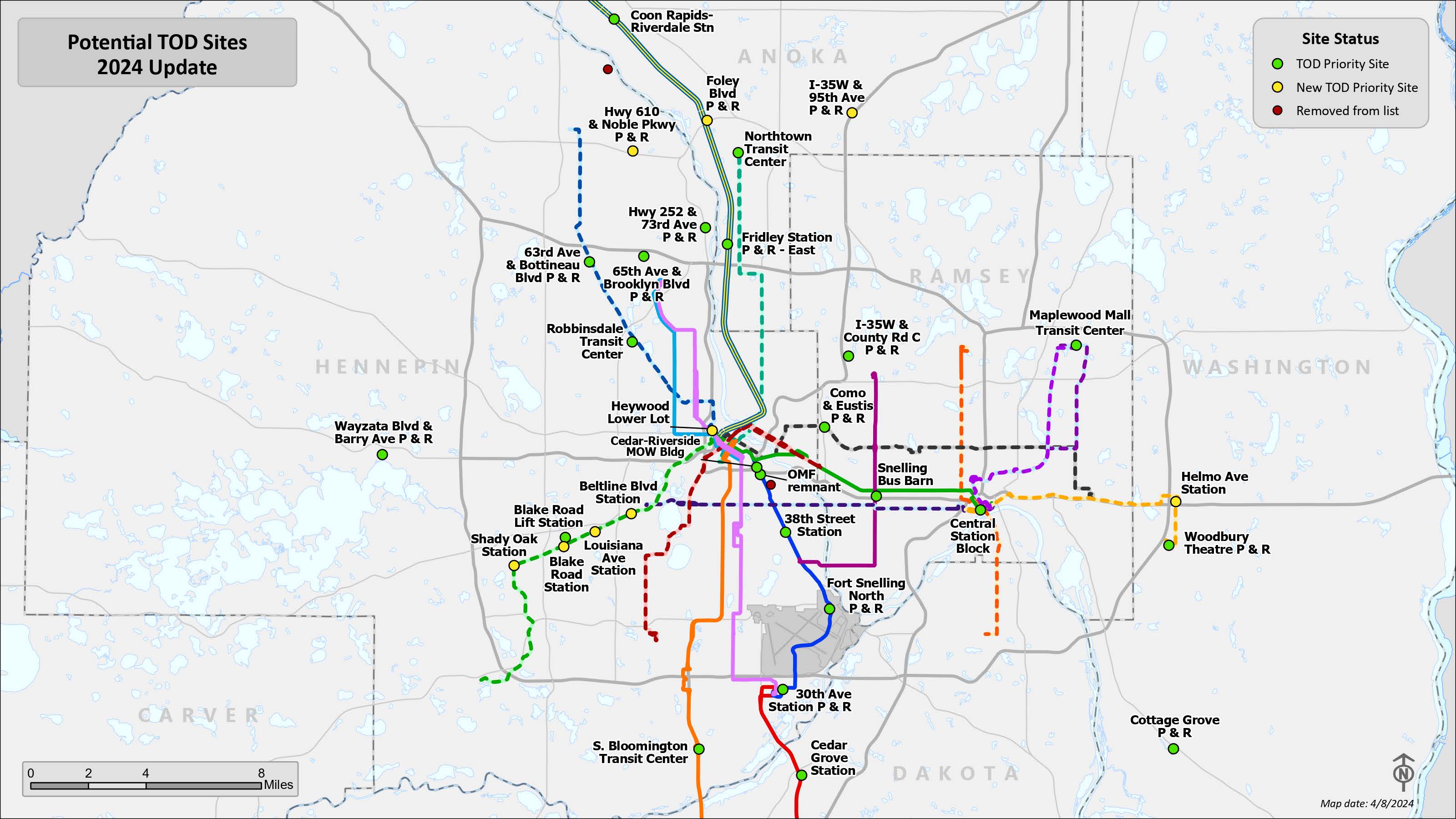
Publicly-owned land along transitways
Learn more about development opportunities by clicking below on the interactive map that identifies publicly-owned land along active and pending transitways in the Minneapolis/St. Paul region.
Access the TOD Office’s free publicly-owned land web map
Access the GIS layer itself (for use with ArcGIS software)
Questions or ideas to improve the database? Refer to the User's Guide or simply contact the TOD Office.
Other resources
TOD Funding Guide – 2020
Equitable Development Scorecard: Developed by the Harrison Neighborhood Association in Minneapolis, the Scorecard was created to make sure that the principles and practices of equitable development, environmental justice and affordability are available to all communities as they plan for economic development and wealth creation that benefits everyone.
Metropolitan Council TOD Guide
University of Minnesota – Center for Transportation Studies’ Research Resources
Learn about development opportunities in Eden Prairie
TOD from the developer’s perspective – it works!
“Ebenezer chose to build TowerLight on Wooddale - Senior Living in its location for a variety of reasons. One major selling point that we love about the area is that the community is so close to the SWLRT Corridor ... We’re excited to be able to incorporate this new, more sustainable way of transportation throughout the Twin Cities Metro Area, and experience the benefits it will bring to our daily lives.”
– Susan Farr, Ebenezer Management Company
“Strong transit-oriented development creates a healthy mix of uses that balance living, working, playing and learning. Mixed-use development requires more planning and risk management, but is essential to leverage public investment in transit infrastructure.”
– Chris Velasco, Co-Founder of PLACE