Current Designs
The Metropolitan Council completed the project's 30% design roll plots in 2022 that reflect the route south of Maryland Avenue in St. Paul. View conceptual design plans for stations in Maplewood and St. Paul.
What’s next?
Once a new Locally Preferred Alternative has been recommended by the Bronze Line Corridor Management Committee later in 2025, project staff will work toward completing 15% Concept Plans for the portion of the project in Maplewood that has changed.
At the conclusion of design and engineering work, the project will have the specifications and drawings that will guide construction. Design concepts that are further studied and specified during design and engineering include:
- Vehicle and vehicle technology
- Route and alignment
- Station locations and amenities
- Traffic
- Pedestrian facilities
- Modifications to existing Maplewood Mall Transit Center Park & Ride
- Landscaping
- Storm water drainage and water quality
- Utilities
- Bridges and underpasses
- Transit service plans
Arcade Street Station
Current Station Location and Design
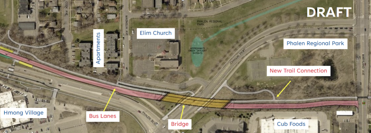
The current location and design of Arcade Street Station and the Bronze Line route through this area includes a new bus rapid transit station and guideway next to Neid Lane, just west of Arcade Street. The location and design, shown below, balances several tradeoffs in this area to provide fast, reliable, and accessible transit service. West of Arcade Street Station, buses will travel in mixed traffic on Neid Lane and Phalen Boulevard toward Payne Avenue Station. East of Arcade Street Station, buses will travel in a new bus-only roadway built north of Phalen Boulevard toward Cook Avenue Station. Arcade Street Station will be at the same level as Neid Lane, then the bus-only roadway will run downhill toward the Bruce Vento Regional Trail corridor. The design includes a new trail connection between Neid Lane and the Bruce Vento Regional Trail.
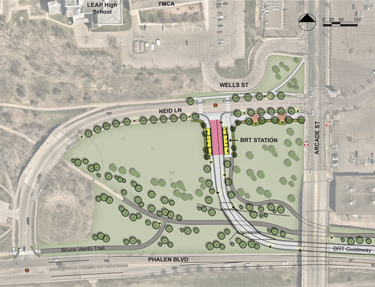
Plan view of the current Arcade Street Station location and design.
Concept renderings of the Arcade Street Station area design
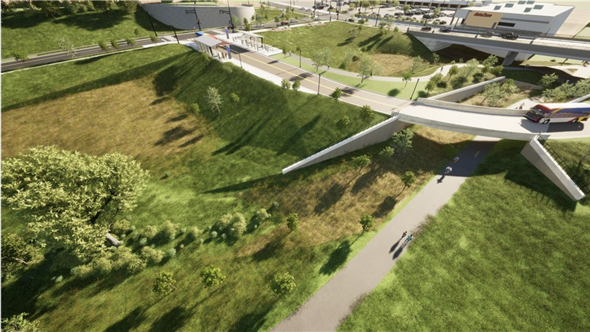
Bird’s eye view of the current Arcade Street Station location and design, looking northeast toward the station and the Arcade and Neid intersection.
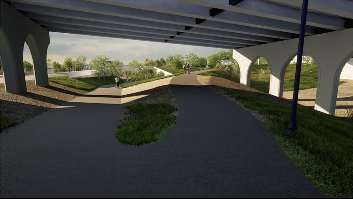
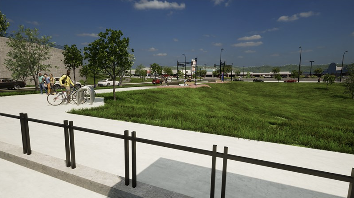
Street-level view from Bruce Vento Regional Trail under the Arcade Street bridge, looking west toward the new trail connection to Arcade and Neid.
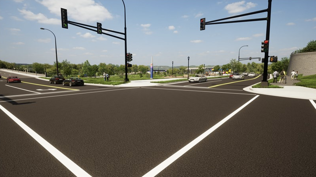
Street-level view from the Arcade and Neid intersection, looking southwest toward the Arcade Street Station.
Street-level view from the Arcade Street Station, looking northeast toward the Arcade and Neid intersection.

Street-level view from the Arcade Street bridge, looking northwest toward the Arcade Street Station
This location and design provides many benefits to the community identified during public engagement:
- It provides convenient access for people of all abilities. There are no steep slopes and is closer to points of interest than a station on Phalen Boulevard.
- It provides better proximity to destinations in the area than a station on Phalen Boulevard, including Seeger Square shopping center, the YMCA, LEAP High School, and the nearby neighborhood.
- It encourages transit-oriented development on private and public property in the area.
- It provides better safety than a station on Phalen Boulevard through lighting, clear sight lines to the platform, and its proximity to Arcade Street.
- For a summary of design changes that occurred for Arcade Street Station, see the following memo: Arcade Street Station History Memo
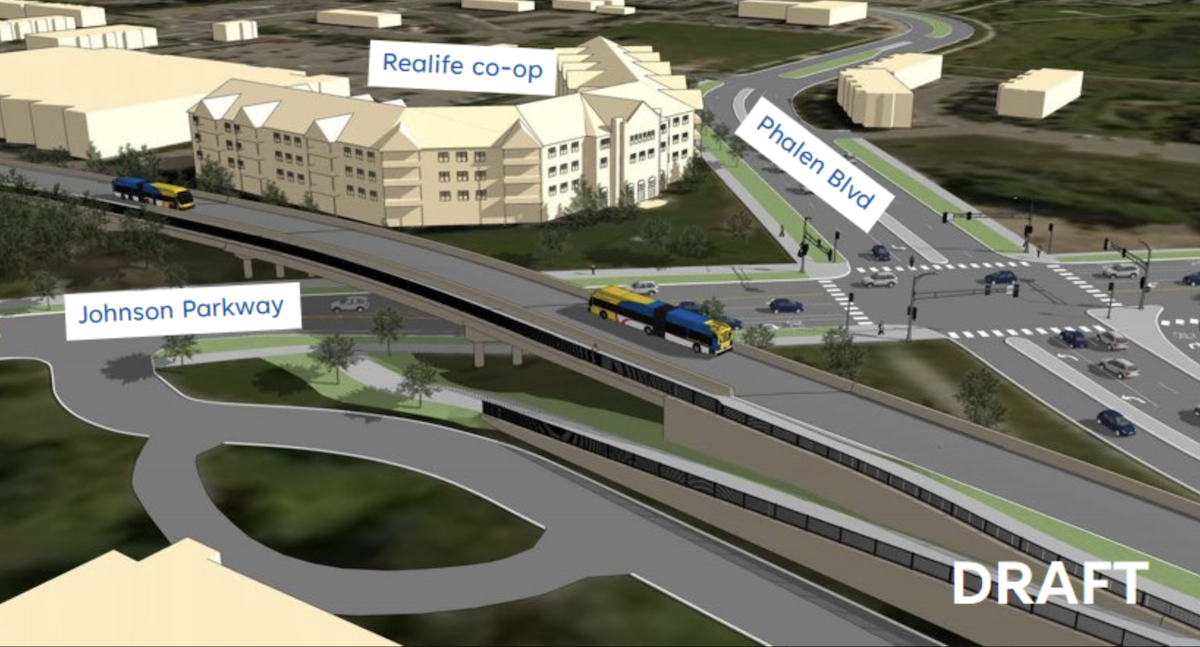
Johnson Parkway
After careful consideration, analysis, and community input, the design option that is advancing is to include a bridge over Johnson Parkway for the BRT guideway. This solution is both cost-effective and minimally impactful, ensuring smooth traffic flow and minimal disruption to the surrounding area.
For a history of past engagement efforts around Johnson Parkway designs, view the Johnson Parkway History Memo.