Back to stations
Central & Spring Station
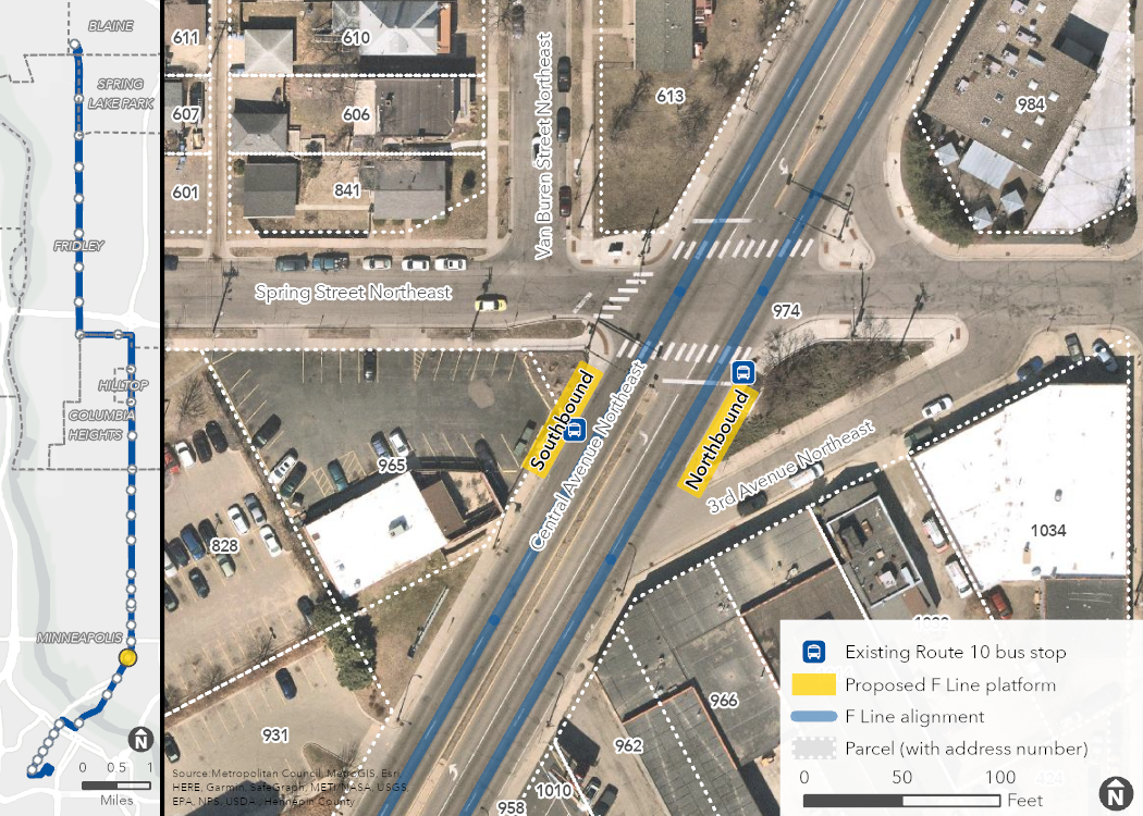
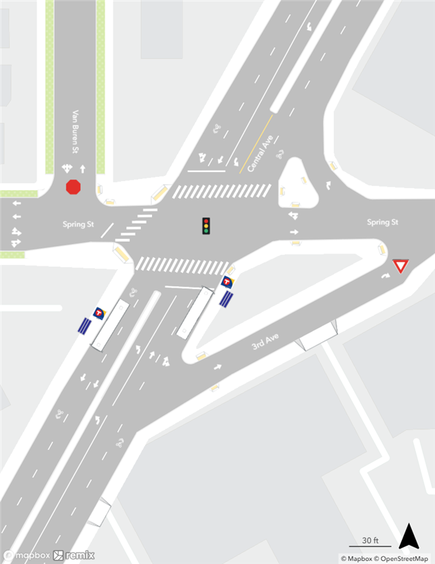
This plan defines two core station components: the station intersection and the location of platforms within the intersection. Other preliminary design details are provided for additional context but are conceptual and will be finalized during the engineering phase of the project. Existing conditions are shown below for reference.
Read the full plan for more detail
Proposed Station Location
Proposed Station Plan
On the image below, click and drag the slider arrows from right to left to show existing conditions, and from left to right to show the proposed station plan.
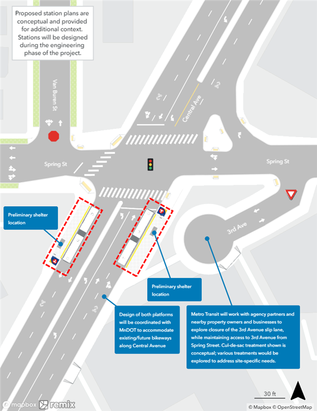 Proposed
 Existing